CPT Q. 098: How and when did ocean island chains like Hawaii form?
Q. 98. Could you comment on Catastrophic Plate Tectonics regarding island chain formation, such as the Hawaiian Islands? Do you take Potassium/Argon radioactive dates as a relative chronology reflecting the ocean floor processes? Did the formation of the Hawaiian Islands take place during the Flood or after the Flood? Can the distances across the Hawaiian Island chain be related to rates of plate movement and subduction in your model? Over what approximate time frame would you envision the Hawaiian Islands forming?
Response:
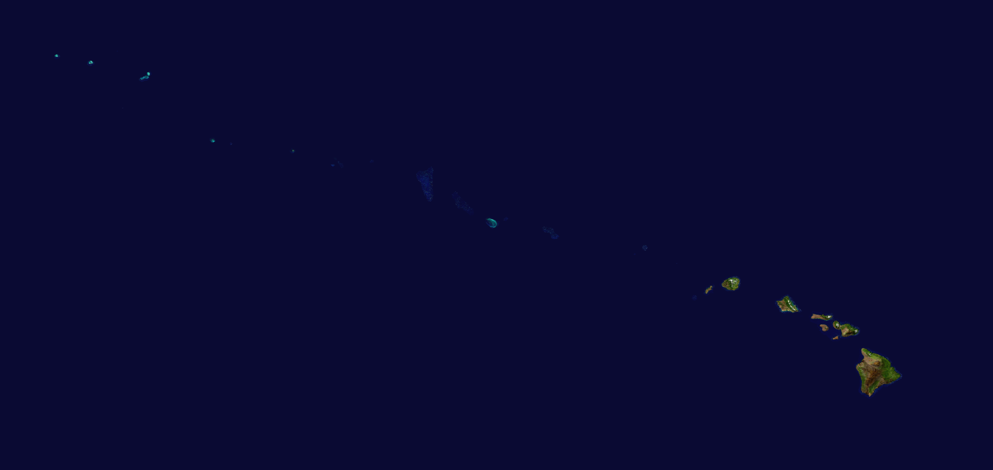
I consider the conventional understanding, namely, that island chains like Hawaii form as the result of an oceanic plate moving over a relatively stationary mantle hot spot/plume, also to be the most obvious and viable explanation within the CPT framework. In regard to whether or not I trust radioisotope dating for providing reliable relative dates for ocean floor processes, including the relative formation times of islands in an ocean island chain, the answer is yes. I gave my reasons in my answer to the first part of question 75 above. Translating the published radioisotope ages for the Hawaiian Island chain into the time line for the Flood, I conclude that most of the chain formed during the Flood. Although I am cautious and somewhat tentative regarding the point in the uniformitarian time scale (which relies almost exclusively on radioisotope determinations) which marks the end of the Flood, the number I commonly use is 5 Ma. This means that all of the submerged Emperor Islands, dated roughly from 40 to 85 Ma, were formed during the Flood, as were all the Northwest Hawaiian Islands, collectively referred to as the Leeward Isles, dated from 7 to 30 Ma. (Here, of course, I am interpreting Ma to signify millions of years of nuclear decay at presently observed decay rates, with approximately 600 Ma of decay having occurred during a single year of actual time during the Genesis Flood.)
This leaves the Hawaiian Archipelago (also known as the Windward Isles), consisting of the islands comprising the U.S. state of Hawaii as possibly having formed in part or wholly after the Flood. The oldest of these islands, Kauai, has lavas dated at 5.1 Ma. Kauai’s Waimea Canyon, also known as the Grand Canyon of the Pacific, which is 14 miles long, a mile wide, 3600 feet deep, and cut through solid basalt, seems to require some extraordinary process for its formation. Tsunamis large enough to overtop the island at the end of or just after the Flood to me seem to be a plausible possibility. I place the formation of the remainder of the Hawaiian Archipelago within the first century or so after the Flood when the hotspot was more active than it is today and the speed of the Pacific Plate was decreasing to its present value.
The distances across the Hawaiian Island chain do reflect the rates of plate movement and subduction in the CPT framework. The total length of the chain is about 5000 km. The radioisotope ages for the part of the chain formed during the Flood range roughly from 5 to 85 Ma, which corresponds to the Flood’s latest stages, including the regressive stage when the Flood waters were draining from the continents. Taking 200 days as an estimate for this time interval gives an average plate speed during that interval of about 1 km/hr or 0.6 mph.
In regard to the other Flood models, those models which do not include any relative motion of the Pacific Plate over the deeper mantle would seem hard pressed in my assessment to explain such a chain of volcanoes whose radioisotope ages vary in such a systematic manner. To me the Hawaiian-Emperor Island chain testifies rather clearly to the reality of large amounts of actual plate motion during the Genesis Flood and thus to the requirement for some sort of model at least approximating that of catastrophic plate tectonics.